Whether you’ve been in Baton Rouge for a day or a decade, you know traffic is a problem. It’s a problem our government is trying desperately to solve.
One of the most problematic areas in Baton Rouge is the I-10 corridor (LA 415 to Essen). During its reconstruction, the Louisiana Department of Transportation and Development (DOTD) needed a website showcasing the project’s progress and keep the public informed of all updates.
The Project
Working with one of the engineering firms managing the project, Gatorworks created a website with two main goals. It needed to ensure Baton Rouge residents could easily access reports from public meetings, as well as check what areas will be impacted from the construction. Besides these two main features, the site was also built to contain a plethora of resources in a variety of file types in a way users could easily select and download.
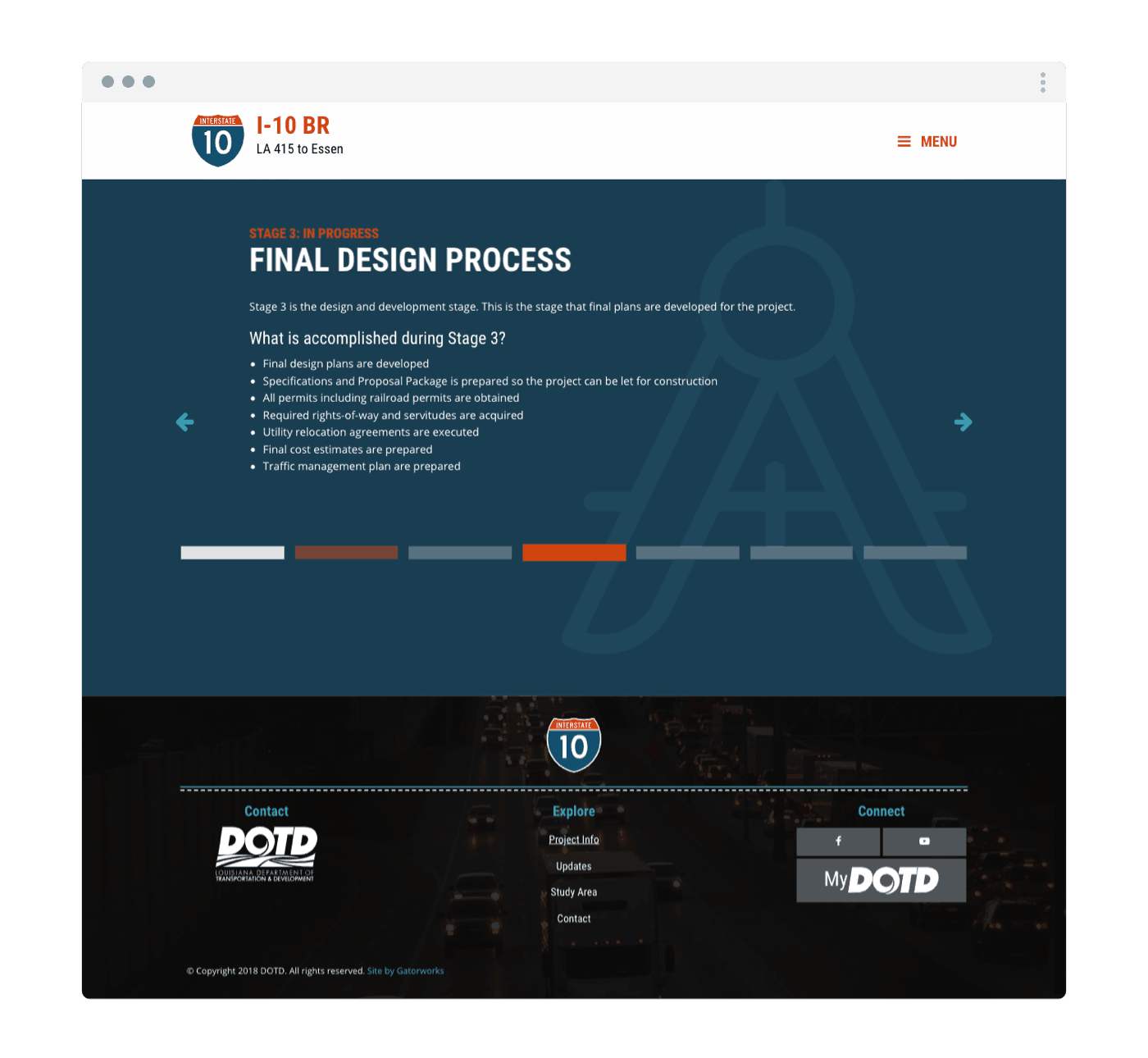
Interactive Development Stages
One of the site’s most important needs was highlighting the various project stages and detail the actions, timelines, and expectations during each stage. We did this through a full-page slider. Accentuating each design with an associated icon and adding a loading effect on the homepage draw attention to the current stage’s progress.
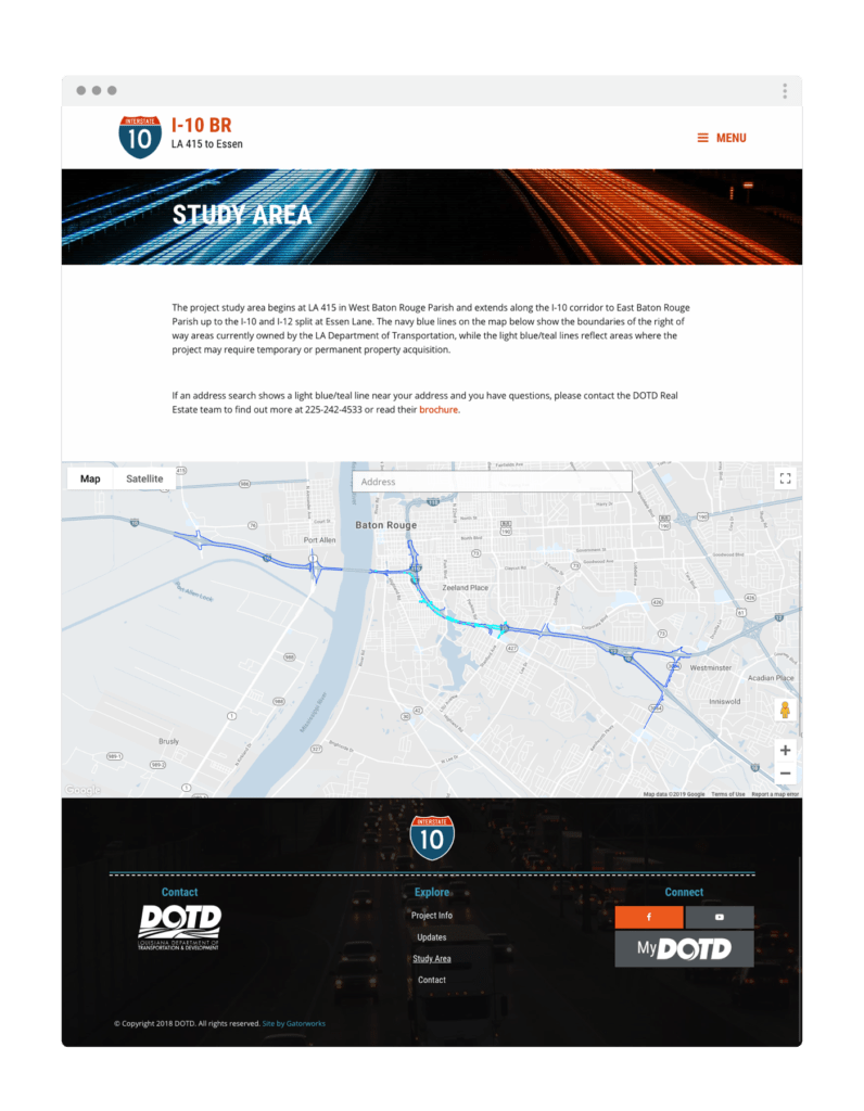
Study Area Map
From adjusting property lines to showing road closures, DOTD felt it was critical to show the areas of impact in an easy-to-use map. This involved a complicated construction of an area study map using Google Maps API with a specific file of data points.
Project Summary
Because I10BR.com is a website created for, and used by, the citizens of Baton Rouge, we strove to create a visually fun and interactive website that Baton Rouge residents will want to visit to get the important info they need.